The Bridge Over The Woodland Ravine
Peasholm Beck marked the northern edge of the Scarborough parish boundary established in the charter of 1256. The extensive development by the civil engineer William Smith, developing Peasholm from allotments and swineries into the park, wasn’t the first break to the northern boundary. Minor tweaking to the beck in the years prior to the lake being dug out must have occurred to suit those who had allotments and kept livestock in the area. But 40 years prior to the landscaping of the park, a significant and permanent break in the northern boundary occurred when the railway line to Whitby was built by the Scarborough and Whitby Railway Company.
The railways contributed to a change in the outlook of the town and led to its rapid expansion. An area of the old boundary along Peasholm Glen that was known as Barrow Cliff, because of the ancient barrows found on the sides of the glen, gave its name to a new housing estate that was built much later in the fields and allotments to the north. The common name of the boundary, Barrow Cliff, moves north, although the actual physical boundary does not. The Barrowcliff estate became the custodian of the old name and the old area that was the Barrow Cliff became known as Peasholm Glen.
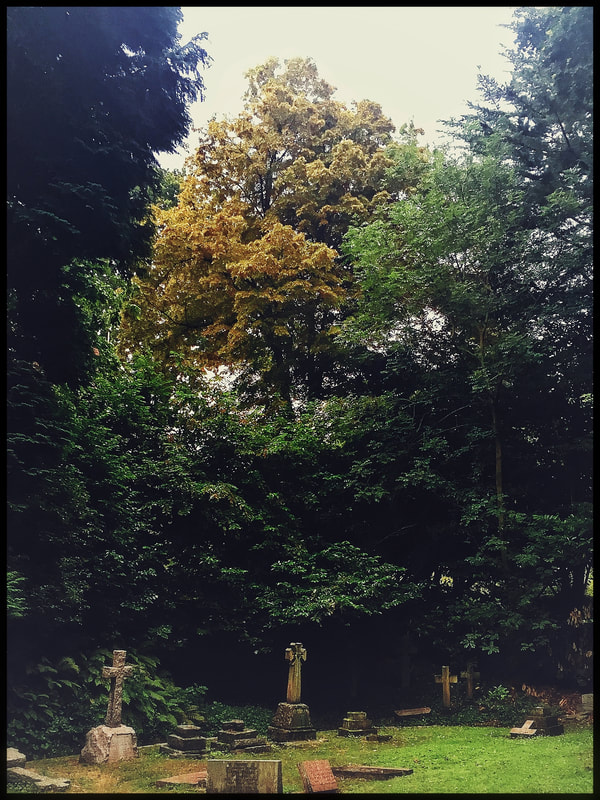
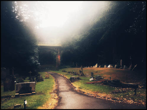
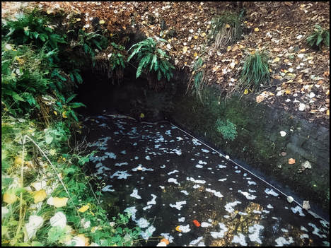
To lay the railway, Peasholm Beck at the Woodlands Ravine area had to be piped underground and a large area of earth needed to be filled in to lay the railway and to build the bridge over the line. As this development was largely done by shovel and cart, you can appreciate what a physically hard job this would have been. At the drain in the fenced-off pond on Woodlands Ravine, the beck line drops under nine metres of heaped aggregate earth where the new Manor Road bridge and railway line was built. On the other side of the bridge, the drain drops to the bottom of the cemetery, which has been dug out into terraces and escarpments. The beck would have meandered right, under the cemetery bridge, and then turned left. The cemetery then opens into a flat grassed area, now full of headstones, and the drain moves forward towards an area of heaped earth four or five metres high before the lily pond.
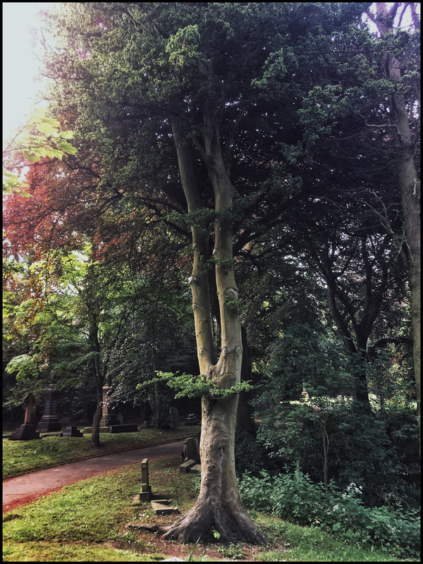
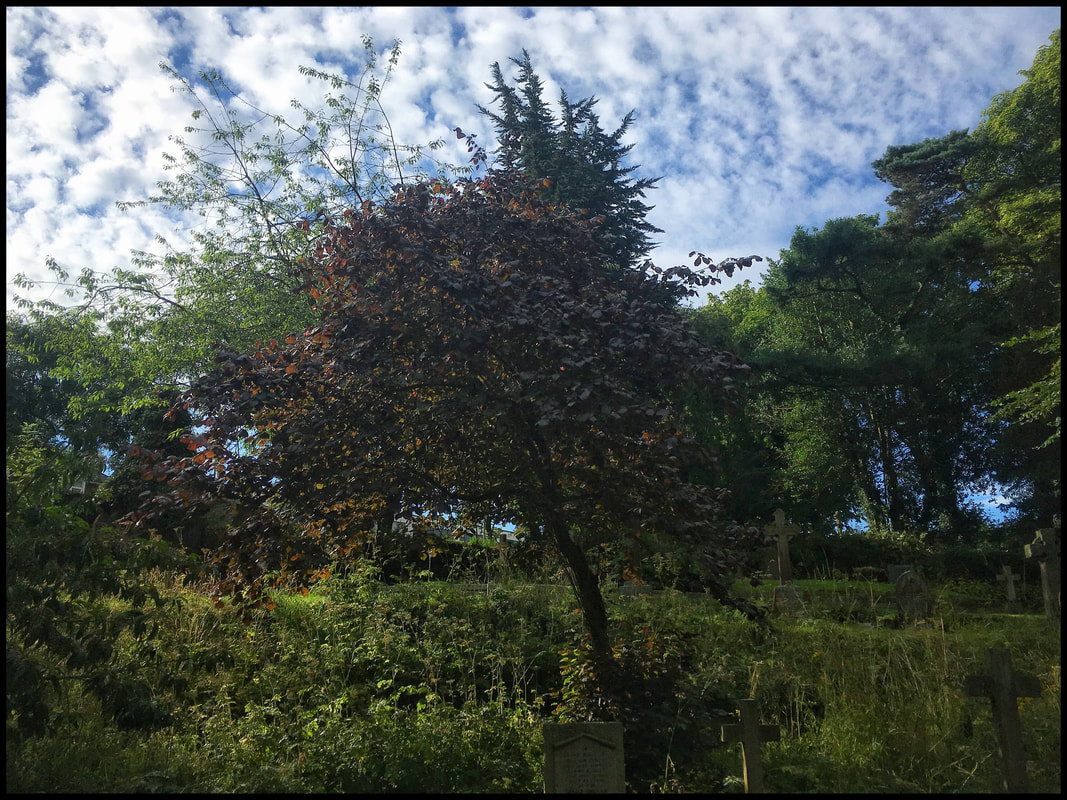
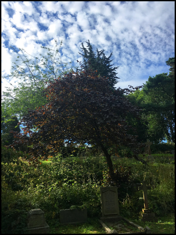
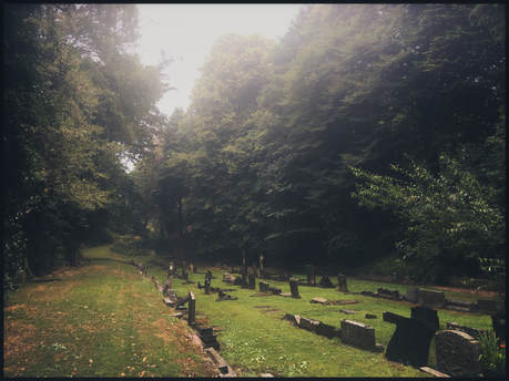
Although it’s a far cry from a bubbling purling brook, in dappled shade these sleepy terraces and hollows are still a beautiful place to walk and a very much overlooked area of Scarborough. The meandering shape of this dank dingle is the result of the beck’s original path. On the bend it seems to have discoloured many of the grave stones with a russet complexion. Imagine what the area must have been like with steam engines rattling over the top.
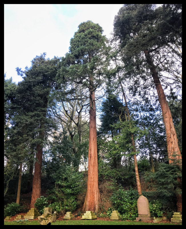
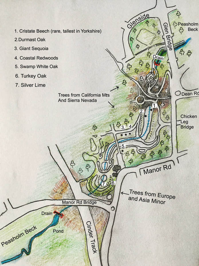
The trees planted in this area seem to be themed, in the same way that the trees planted in the glen development were themed around natural forest environments. The tree species in this are from the Californian mountains and the Sierra Nevada. For example, there is a Giant Redwood, Coastal Redwoods and a Swamp White Oak, a rare tree in northern England. There is an aged Durmast Oak tree and a Cristate Beech, another rare tree and the tallest of its kind in Yorkshire. The trees at the very top of the glen near Manor Road Bridge seem to be themed around the tree species from Europe and Asia Minor, containing such specimens as a Cut-Leafed Lime, Turkey Oak and Swedish White Beam.
When the railway line running north was being laid, the Victorian values of progress and industry were prevalent throughout the country. Great cultural changes were occurring as a result of a different attitude towards the land’s resources. Back-filling Peasholm Beck and landscaping with the clods wet earth at Woodlands Ravine and Manor Road cemetery hardly equates with the great engineering feats of the time. But the decision to develop the area still represents a significant break with the past as the town expanded beyond its old boundaries. And yet while doing so it still seems it could help but stick to its old dispositions; a landscape that was previously a watercourse lined with ancient burial mounds was developed into a watercourse now lined with graves.
The construction of the bridge and the railway are symbols of progress through industry but the ancient function of this area as a burial ground didn’t change. Progress comes and goes and dithers about, and the railway was eventually closed and the line lifted by 1968, leaving the cinder track in its place. Victorian progress through industry drove ordinary people off small holdings and allotments on common lands into the industrial towns which created the great poverty we now associate with the Victorian era. Driving the population off their small holdings occurred using a series of enclosure acts in parliament that initiated the enclosure of open fields previously held in common and handed these lands over to be managed by land owners. People who were happy to scrape by on small holdings were forced into industry. They and their children were forced to work long hours in appalling conditions to access food and shelter they had previously had on common land, thus creating a landless class who had no way of surviving other than selling their labour. It would have been easy to find the workers to form the terraces and backfill the glen to lay the railway and the bridge over the ravine but I can’t imagine it was nice work.
“Nearly half the country is owned by land millionaires which equates to 0.06% of the population, while most of us spend half our working lives paying off the debt on a patch of land barely large enough to accommodate a dwelling and a washing line” - Simon Fairlie, author.
Peasholm Beck marked the northern edge of the Scarborough parish boundary established in the charter of 1256. The extensive development by the civil engineer William Smith, developing Peasholm from allotments and swineries into the park, wasn’t the first break to the northern boundary. Minor tweaking to the beck in the years prior to the lake being dug out must have occurred to suit those who had allotments and kept livestock in the area. But 40 years prior to the landscaping of the park, a significant and permanent break in the northern boundary occurred when the railway line to Whitby was built by the Scarborough and Whitby Railway Company.
The railways contributed to a change in the outlook of the town and led to its rapid expansion. An area of the old boundary along Peasholm Glen that was known as Barrow Cliff, because of the ancient barrows found on the sides of the glen, gave its name to a new housing estate that was built much later in the fields and allotments to the north. The common name of the boundary, Barrow Cliff, moves north, although the actual physical boundary does not. The Barrowcliff estate became the custodian of the old name and the old area that was the Barrow Cliff became known as Peasholm Glen.
To lay the railway, Peasholm Beck at the Woodlands Ravine area had to be piped underground and a large area of earth needed to be filled in to lay the railway and to build the bridge over the line. As this development was largely done by shovel and cart, you can appreciate what a physically hard job this would have been. At the drain in the fenced-off pond on Woodlands Ravine, the beck line drops under nine metres of heaped aggregate earth where the new Manor Road bridge and railway line was built. On the other side of the bridge, the drain drops to the bottom of the cemetery, which has been dug out into terraces and escarpments. The beck would have meandered right, under the cemetery bridge, and then turned left. The cemetery then opens into a flat grassed area, now full of headstones, and the drain moves forward towards an area of heaped earth four or five metres high before the lily pond.
Although it’s a far cry from a bubbling purling brook, in dappled shade these sleepy terraces and hollows are still a beautiful place to walk and a very much overlooked area of Scarborough. The meandering shape of this dank dingle is the result of the beck’s original path. On the bend it seems to have discoloured many of the grave stones with a russet complexion. Imagine what the area must have been like with steam engines rattling over the top.
The trees planted in this area seem to be themed, in the same way that the trees planted in the glen development were themed around natural forest environments. The tree species in this are from the Californian mountains and the Sierra Nevada. For example, there is a Giant Redwood, Coastal Redwoods and a Swamp White Oak, a rare tree in northern England. There is an aged Durmast Oak tree and a Cristate Beech, another rare tree and the tallest of its kind in Yorkshire. The trees at the very top of the glen near Manor Road Bridge seem to be themed around the tree species from Europe and Asia Minor, containing such specimens as a Cut-Leafed Lime, Turkey Oak and Swedish White Beam.
When the railway line running north was being laid, the Victorian values of progress and industry were prevalent throughout the country. Great cultural changes were occurring as a result of a different attitude towards the land’s resources. Back-filling Peasholm Beck and landscaping with the clods wet earth at Woodlands Ravine and Manor Road cemetery hardly equates with the great engineering feats of the time. But the decision to develop the area still represents a significant break with the past as the town expanded beyond its old boundaries. And yet while doing so it still seems it could help but stick to its old dispositions; a landscape that was previously a watercourse lined with ancient burial mounds was developed into a watercourse now lined with graves.
The construction of the bridge and the railway are symbols of progress through industry but the ancient function of this area as a burial ground didn’t change. Progress comes and goes and dithers about, and the railway was eventually closed and the line lifted by 1968, leaving the cinder track in its place. Victorian progress through industry drove ordinary people off small holdings and allotments on common lands into the industrial towns which created the great poverty we now associate with the Victorian era. Driving the population off their small holdings occurred using a series of enclosure acts in parliament that initiated the enclosure of open fields previously held in common and handed these lands over to be managed by land owners. People who were happy to scrape by on small holdings were forced into industry. They and their children were forced to work long hours in appalling conditions to access food and shelter they had previously had on common land, thus creating a landless class who had no way of surviving other than selling their labour. It would have been easy to find the workers to form the terraces and backfill the glen to lay the railway and the bridge over the ravine but I can’t imagine it was nice work.
“Nearly half the country is owned by land millionaires which equates to 0.06% of the population, while most of us spend half our working lives paying off the debt on a patch of land barely large enough to accommodate a dwelling and a washing line” - Simon Fairlie, author.
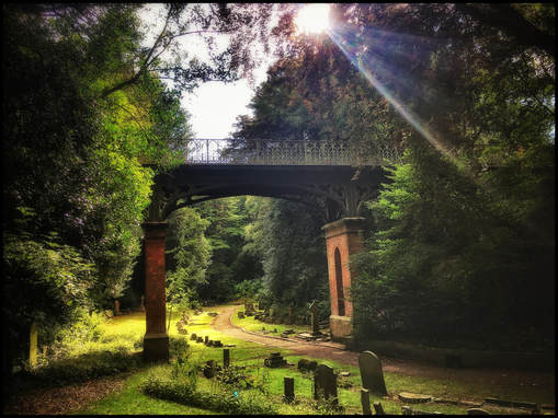
Following the beck line under the cemetery bridge
|
after the bridge the beck turns
|
and heads in a straight line towards a raised area of earth before the lillly pond.
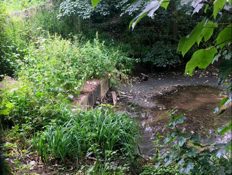
Beginning of the drain at Woodlands Ravine
|
End of the drain after the Lilly pond in Peasholm Glen
|
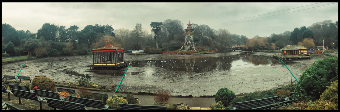
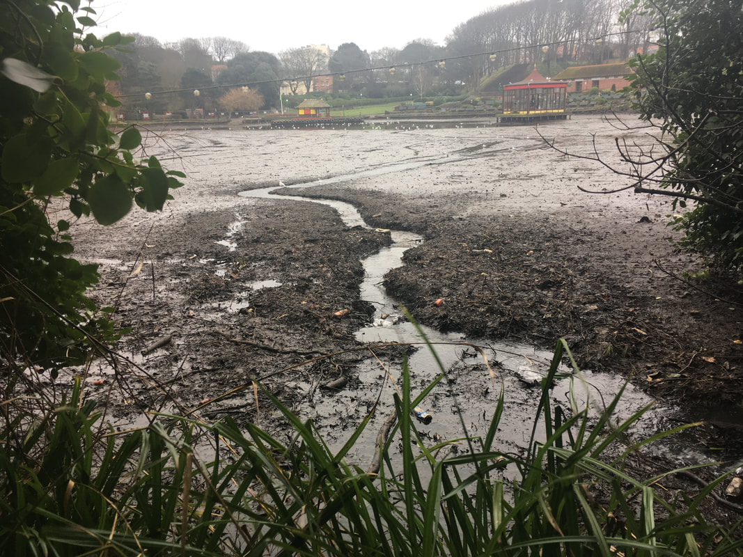
Peasholm Lake was emptyied for dredging earlier this year
|
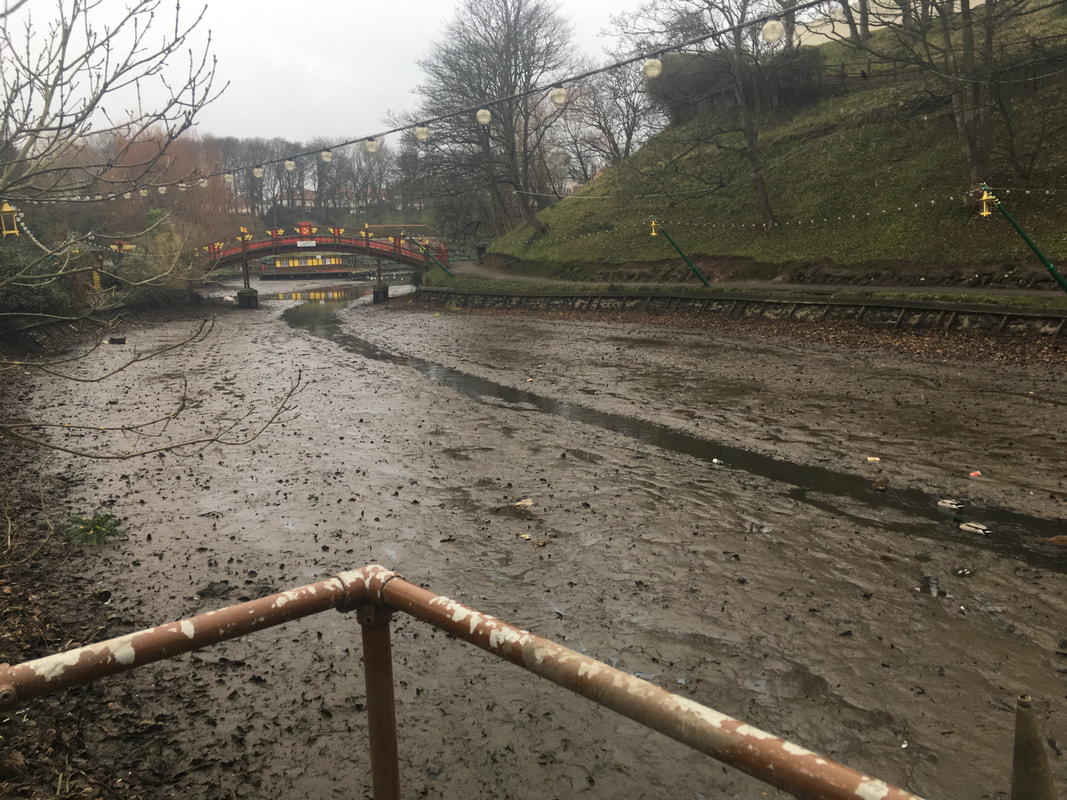
after dredging Peasholm Beck more or less then followed its original course prior to the development of the park back in 1906
|